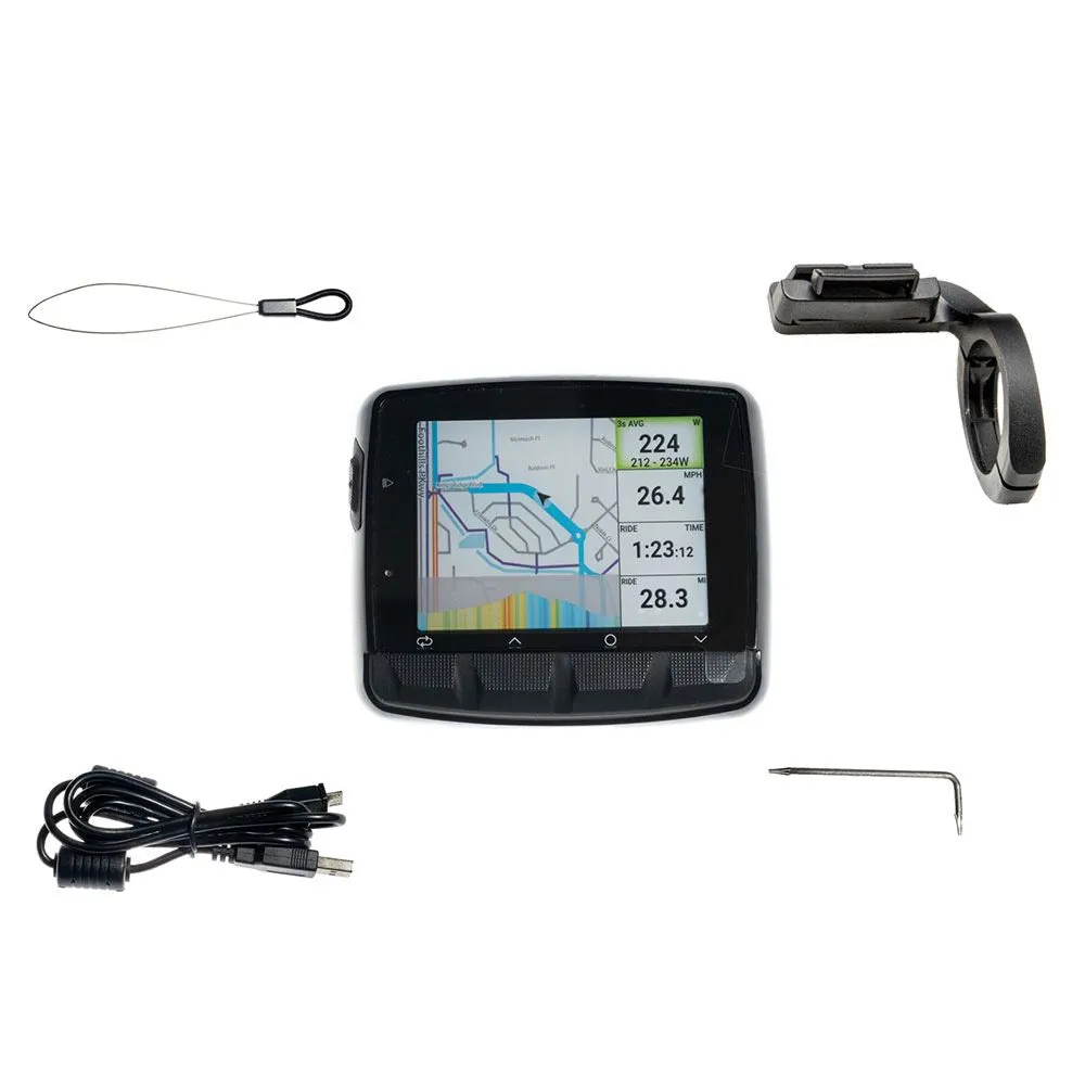
Stages Dash L50 Wireless GPS Cycling Computer
It's brighter. It's easier to use. And it's smarter. Welcome to the Stages Dash - L50 GPS computer, featuring a brilliant full-color EverBrite™ display, bike-specific maps with navigation and track elevation, and a full range of training and fitness features to suit both beginners and seasoned pros. With ANT and Bluetooth connectivity, you can connect the Stages Dash to almost any device, and the screen can be easily configured to show any combination of data you prefer, in either landscape or portrait mode. The Stages Dash is supported by an all-new Stages LINK app that is used for setup, wireless orientation file transfer, on-screen text and phone notifications, and comprehensive analysis of ride data and training history, all through a free app. Compared to the Stages Dash - M50 GPS computer, the L50 has a larger screen, more data fields (up to 16), and a larger battery for longer run times.
Specifications:
- Screen size: 2.75"" (68 mm) measured diagonally
- Overall dimensions: 85 mm wide x 73 mm long x 20 mm deep (horizontal)
- Weight: 126g
- Satellite network: GPS and QZSS with SBAS (WAAS, EGNOS, MSAS and GAGAN)
- Brackets: Lightweight aluminum (22g) low-profile 31.8mm front bracket included; others available as accessories
- Battery: Rechargeable LiPO (USB)
- Battery life: Up to 14 hours of real-time backlighting with 30% screen brightness
- Water resistance: IPX7
- Compatibility: iOS 9.3 including iPhone 4S and later; Android 6.0 (Bluetooth Smart)
- File compatibility: FIT, .GPX, .TCX
- Recording interval: Live
- Warnings: Audio and visual, selectable for users
- Data transfer: USB and Bluetooth
- Sensor compatibility: ANT and Bluetooth speed/cadence, heart rate and sensor meter
Highlights:
- EverBrite™ high-resolution full-color display with backlight, selectable brightness and automatic auto-dimming mode
- Night mode (black background).
- Easy installation and use.
- Synchronize trips and training via Bluetooth or USB.
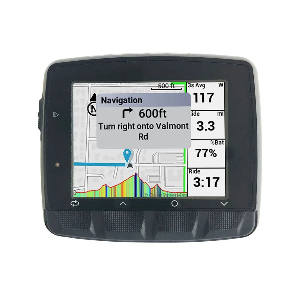
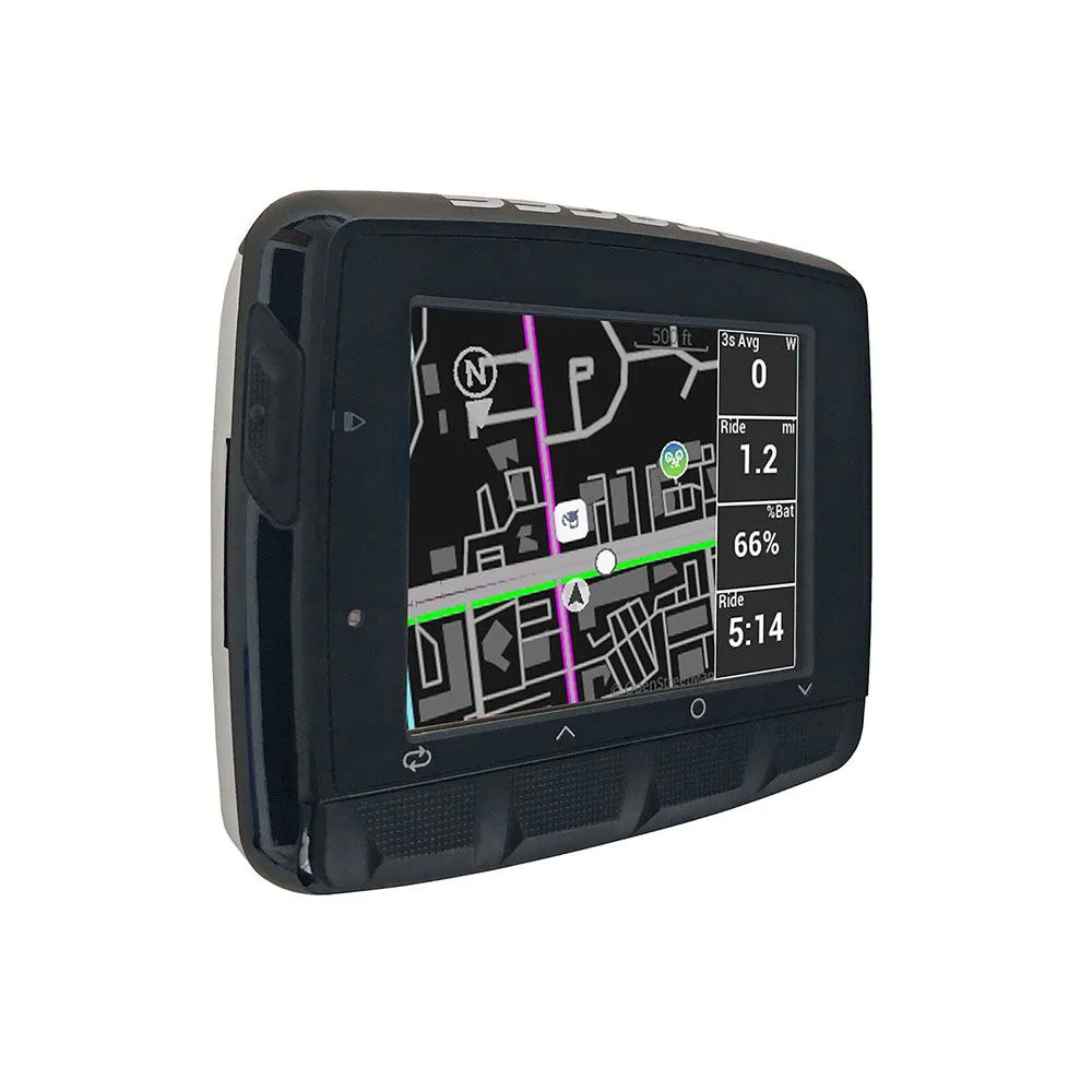
- Cycling-specific OSM-based with color-coded roads, bike paths and trails
- Find places near your location: bike shops, cafes, pubs, gas stations, etc.
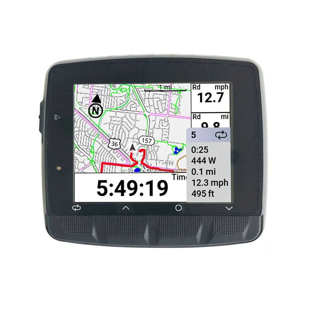
- Follow courses in the .FIT, .GPX or .TCX file format
- Free custom course builder via Stages LINK including user-defined points of interest (city boundary signs, etc.)
- Turn-by-Turn navigation with on-screen and audio alerts.
- Pre-installed with base maps (North America) with additional regions available for free download
- Course climb/elevation profile including progress and color-coded percentage grade
- Fully customizable layout: landscape or portrait mode, user-defined profiles, preset and custom screen layouts and content with up to 16 data fields per screen
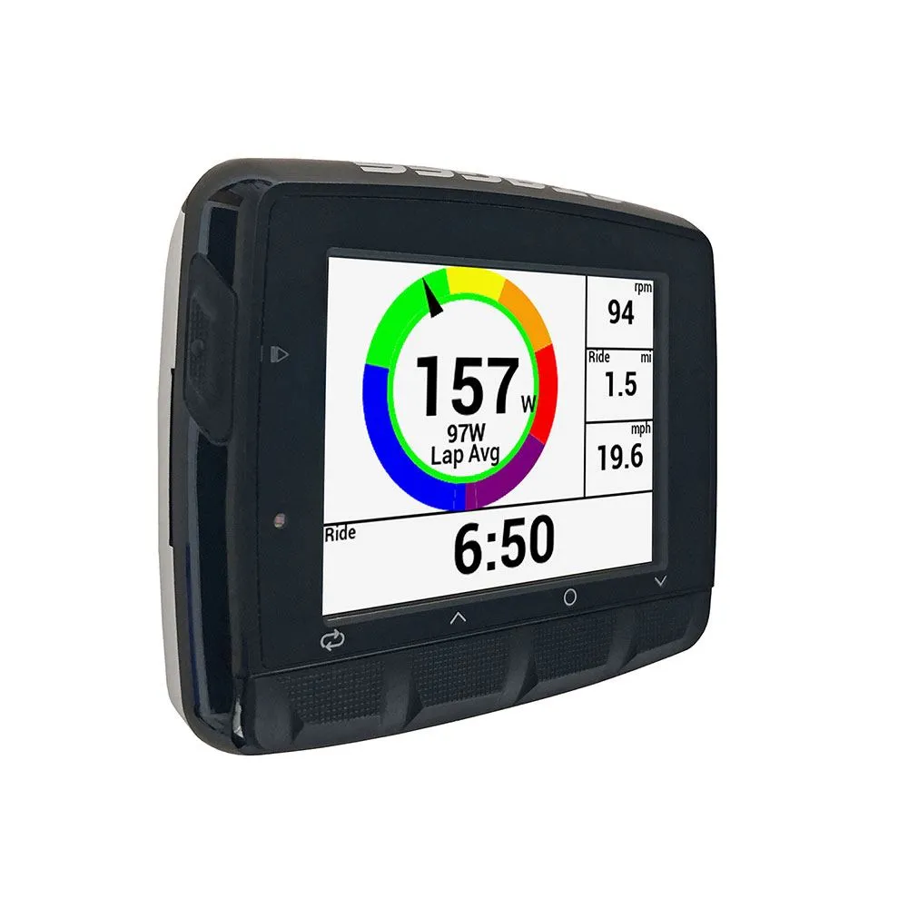
- GPS-based power, average and maximum speed, distance, ride/lap time with automatic start/stop
- Pair with Android and iOS for file uploads and on-screen pop-ups for calls, texts, and messages.
- Handling of power meter on the device (pair, reset, show battery status).
- Advanced power measurements including TSS, IF and Normalized Power.
- FTP and heart rate zone calculator
- Color-coded power, HR zones and interval progress graph
- Pre-loaded with workouts; more can be added via .FIT files from Stages LINK or third-party apps
- Training calendar and advanced analytics available via free LINK app for Stages
- Futureproof: Regular Stash Dash software updates add new features for years to come
- Secondary speed/cadence sensor compatible (available as accessory)


